|
|
|
Advertisements:
GeographyLocation
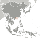
Este de Asia, bordeando el mar de China meridional y China Geographic coordinates
22 15 N, 114 10 E
Map references
Sudeste de Asia
Area
Total 1,104 sq km
Land 1,054 sq km Water 50 sq km Area - comparative
Seis veces el tamaño de Washington, DC Land boundaries
Total 30 km
Regional border China 30 km Coastline
733 km
Maritime claims
Territorial sea 3 nm
Climate
Monzón subtropical; frío y húmedo en invierno, cálido y lluvioso desde la primavera hasta el verano, cálido y soleado en otoño Terrain
Colinas a montañoso con pendientes pronunciadas; tierras bajas en el norte Elevation extremes
Lowest point South China Sea 0 m
Highest point Tai Mo Shan 958 m Natural resources
Puerto de aguas profundas pendiente, feldespato Land use
Arable land 5.05%
Permanent crops 1.01% Other 93.94% (2001) Irrigated land
NA; note - included in the total for China (1998 est.) Natural hazards
Tifones ocasionales
Environment - current issues
Contaminación del aire y agua de rápida urbanización Environment - international agreements
Party to
Marine Dumping (miembro asociado), contaminación de la nave (miembro asociado) Geography - note
Compuesto por más de 200 islas
Comentarios
Anade un comentario nuevo:: |
Advertisement
Login
Hong Kong S. A. R. (Special Administrative Region):
 
GPS puntos de Hong Kong S. A. R. (Special Administrative Region)
|
||||||||

 En 1841, ocupada por el Reino Unido, Hong Kong fue cedida formalmente por China el año siguiente; varias tierras adyacentes fueron añadidos posteriormente en el siglo XIX. En virtud de un acuerdo firmado por China y el Reino Unido el 19 de diciembre de 1984, Hong Kong se convirtió en el Hong Kong región administrativa especial (RAE) de la República Popular de China el 01 de julio de 1997. En este acuerdo, China prometió que bajo la fórmula "un país, dos sistemas", no se impondría el sistema económico socialista de China en Hong Kong y que Hong Kong disfruten de un alto grado de autonomía en todos los asuntos excepción extranjeros y asuntos de defensa para los próximos 50 años.