Ruisseau la Woltz
50°3'0" N
5°52'0" E
16:42 (CEST - UTC/GMT+2)
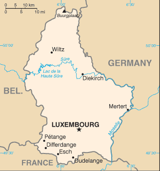
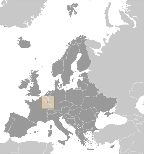
Ruisseau la Woltz (Ruisseau la Woltz) es un/una corriente (class H - Hidrográfica) en (Luxembourg (general)), Luxemburgo (Europe) con un código de región de Americas/Western Europe.
Sus coordenadas son 50°3'0" N y 5°52'0" E en formato DMS (grados, minutes, segundos) o 50.05 y 5.86667 (en grados decimales). Su posición UTM es GR04 y su referencia Joint Operation Graphics es NM31-06.
La hora local actual es 16:42; el sol sale a las 07:54 y se pone a las 20:01 hora local (Europe/Luxembourg UTC/GMT+2). La zona horaria de Ruisseau la Woltz es UTC/GMT+1, pero como horario de verano (DST) es en efecto la zona horaria actual es UTC/GMT+2.
En 2024 el horario de verano comienza el 31 Mar 2024 y termina el 27 Oct 2024.
A Corriente es un cuerpo de agua corriente en movimiento a un nivel inferior en un canal en tierra.
|
Advertisements:
Advertisements:
|
El tiempo Ruisseau la Woltz (Nubosidad, Temperatura, Velocidad del viento y Precipitación mm probab.)
Sat
Apr 27
~4 l/m2 67%
9 °C min
13 °C max
25 km/h
Thu Jan 1
|
Sun
Apr 28
~3 l/m2 60%
9 °C min
12 °C max
36 km/h
Thu Jan 1
|
Mon
Apr 29
5 °C min
11 °C max
19 km/h
Thu Jan 1
|
Tue
Apr 30
~5 l/m2 73%
8 °C min
19 °C max
15 km/h
Thu Jan 1
|
Wed
May 1
~12 l/m2 63%
9 °C min
20 °C max
17 km/h
Thu Jan 1
|
Thu
May 2
~10 l/m2 83%
12 °C min
17 °C max
19 km/h
Thu Jan 1
|
|
|
Mapa y Fotos Ruisseau la Woltz
--- No hay comentarios ---
Anade un comentario nuevo::
|
Login
Luxemburgo (Luxembourg City):
Advertisement
GPS puntos cerca de Ruisseau la Woltz
GPS puntos de Luxemburgo (Luxembourg City)
 Brouch District De Grevenmacher
Staal District De Diekirch
|