16°49'60" S
35°19'60" E
~29m asl
02:41 (CAT - UTC/GMT+2)
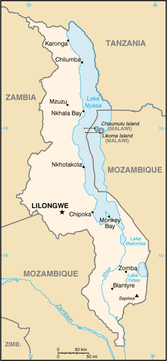
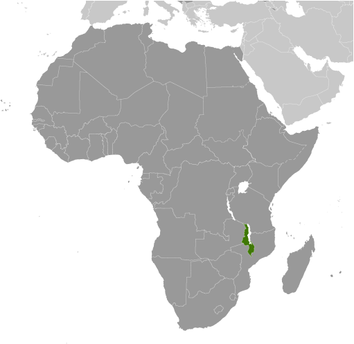
Nyamadzere River (Nyamadzere River) es un/una corriente (class H - Hidrográfica) en Southern Region (Malawi (general)), Malawi (Africa) con un código de región de Africa/Middle East. Se encuentra a una altitud de 29 metros sobre el nivel del mar.
Nyamadzere River se conoce también como Nyamadzere River, Nyamadzere Stream, Nyamazere River.
Sus coordenadas son 16°49'60" S y 35°19'60" E en formato DMS (grados, minutes, segundos) o -16.8333 y 35.3333 (en grados decimales). Su posición UTM es YG43 y su referencia Joint Operation Graphics es SE36-04.
La hora local actual es 02:41; el sol sale a las 08:54 y se pone a las 21:01 hora local (Africa/Blantyre UTC/GMT+2). La zona horaria de Nyamadzere River es UTC/GMT+2
En 2024 el horario de verano comienza el - y termina el -.
A Corriente es un cuerpo de agua corriente en movimiento a un nivel inferior en un canal en tierra.
|
Advertisements:
Advertisements:
|
El tiempo Nyamadzere River (Nubosidad, Temperatura, Velocidad del viento y Precipitación mm probab.)
Fri
Apr 26
23 °C min
28 °C max
13 km/h
Thu Jan 1
|
Sat
Apr 27
~8 l/m2 59%
16 °C min
24 °C max
18 km/h
Thu Jan 1
|
Sun
Apr 28
~4 l/m2 62%
18 °C min
23 °C max
17 km/h
Thu Jan 1
|
Mon
Apr 29
15 °C min
26 °C max
13 km/h
Thu Jan 1
|
Tue
Apr 30
17 °C min
32 °C max
11 km/h
Thu Jan 1
|
Wed
May 1
17 °C min
33 °C max
10 km/h
Thu Jan 1
|
|
|
Nyamadzere River (Southern Region) 7 días de previsión
Mapa y Fotos Nyamadzere River
--- No hay comentarios ---
Anade un comentario nuevo::
|
Login
Malawi (Lilongwe):
Advertisement
GPS puntos cerca de Nyamadzere River
GPS puntos de Malawi (Lilongwe)
|

 Temba Island (2 km)
  Kalumbi (4 km)
  Panga (4 km)
  Penga Stream (4 km)
  Phanga (4 km)
  Chasuka (4 km)
  Chazuka (4 km)
  Kada (6 km)
  Khada (6 km)
  Nyamula (6 km)
  Chamaka (6 km)
  Mchengamalembo (6 km)
  Mtengampiri (7 km)
  Vizharona (7 km)
  Lundu (7 km)
  Nyamula (8 km)
  Gandale (9 km)


