21°20'56" N
15°45'45" W
~268m asl
03:26 (WET - UTC/GMT+0)
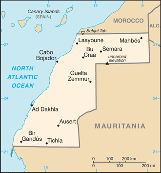
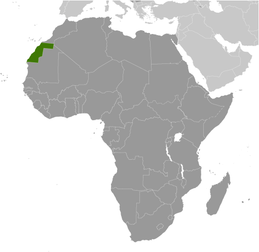
Lagwiyer Labyad (Lagwiyer Labyad) es un/una colina (class T - hipsográfica) en Western Sahara (general), Sahara Occidental [ Indeterminado ] (Africa) con un código de región de Africa/Middle East. Se encuentra a una altitud de 268 metros sobre el nivel del mar.
Lagwiyer Labyad se conoce también como Lagwiyer Labyad, Legueir Labiad, Legüeir Labiad.
Sus coordenadas son 21°20'56" N y 15°45'45" W en formato DMS (grados, minutes, segundos) o 21.3489 y -15.7625 (en grados decimales). Su posición UTM es DJ26 y su referencia Joint Operation Graphics es NF28-10.
La hora local actual es 03:26; el sol sale a las 08:54 y se pone a las 21:01 hora local (Africa/El_Aaiun UTC/GMT+0). La zona horaria de Lagwiyer Labyad es UTC/GMT+0
En 2024 el horario de verano comienza el - y termina el -.
A Colina es una elevación redondeada de forma limitada elevarse por encima de las tierras circundantes con el alivio local de menos de 300 m.
|
Advertisements:
Advertisements:
|
El tiempo Lagwiyer Labyad (Nubosidad, Temperatura, Velocidad del viento y Precipitación mm probab.)
Tue
Apr 23
35 °C min
36 °C max
9 km/h
Thu Jan 1
|
Wed
Apr 24
22 °C min
38 °C max
32 km/h
Thu Jan 1
|
Thu
Apr 25
23 °C min
36 °C max
31 km/h
Thu Jan 1
|
Fri
Apr 26
~2 l/m2 51%
23 °C min
34 °C max
47 km/h
Thu Jan 1
|
Sat
Apr 27
21 °C min
34 °C max
27 km/h
Thu Jan 1
|
Sun
Apr 28
18 °C min
32 °C max
30 km/h
Thu Jan 1
|
|
|
Lagwiyer Labyad (Western Sahara (general)) 7 días de previsión
Mapa y Fotos Lagwiyer Labyad
--- No hay comentarios ---
Anade un comentario nuevo::
|
Login
Sahara Occidental [ Indeterminado ] (El Aaiun):
Advertisement
GPS puntos cerca de Lagwiyer Labyad
GPS puntos de Sahara Occidental [ Indeterminado ] (El Aaiun)
|