English   Română   Español   Français   Deutsch  

getamap.net

Africa

Oceania

Asia

America del Norte

Europa

America del Sur

La Antártida


Cow Pasture


17°37'0" N
63°15'0" W
01:25 (AST - UTC/GMT--4)

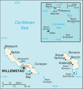
Cow Pasture (Cow Pasture) es un/una localidad (class L - Zona de) en (Netherlands Antilles (general)), Antillas Holandesas [ Países Bajos ] (North America) con un código de región de Americas/Western Europe.

Sus coordenadas son 17°37'0" N y 63°15'0" W en formato DMS (grados, minutes, segundos) o 17.6167 y -63.25 (en grados decimales). Su posición UTM es ME74 y su referencia Joint Operation Graphics es NE20-11.

La hora local actual es 01:25; el sol sale a las 08:54 y se pone a las 21:01 hora local (America/Curacao UTC/GMT-4). La zona horaria de Cow Pasture es UTC/GMT-4
En 2024 el horario de verano comienza el - y termina el -.

A Localidad es un área menor de edad o lugar de carácter mixto y no especificado o límites indefinidos.


Country
 Advertisements:


 Advertisements:


El tiempo Cow Pasture (Nubosidad, Temperatura, Velocidad del viento y Precipitación mm probab.)

Tue


Apr 23
Clound 30-10-0-10
~1 l/m2 34%
 
27 °C min
28 °C max
27 km/h
Thu Jan 1

Wed


Apr 24
Clound 20-10-0-40
~4 l/m2 40%
 
26 °C min
28 °C max
29 km/h
Thu Jan 1

Thu


Apr 25
Clound 20-50-10-30 Mist Lightning
~5 l/m2 44%
 
26 °C min
27 °C max
33 km/h
Thu Jan 1

Fri


Apr 26
Clound 20-10-10-80
~0.4 l/m2 25%
 
26 °C min
27 °C max
30 km/h
Thu Jan 1

Sat


Apr 27
Clound 20-0-60-70 Lightning
~1 l/m2 55%
 
26 °C min
27 °C max
30 km/h
Thu Jan 1

Sun


Apr 28
Clound 0-10-50-100 Lightning
 
26 °C min
27 °C max
28 km/h
Thu Jan 1

El tiempo Graph

Mapa y Fotos Cow Pasture


Comentarios

--- No hay comentarios ---


Anade un comentario nuevo::


Tienes que ingresar para anadir un comentario!


Login


Register

¿Olvidó contraseña?

Antillas Holandesas [ Países Bajos ] (Kingdom Of The Netherlands):
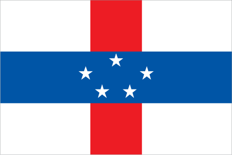
Country Flag
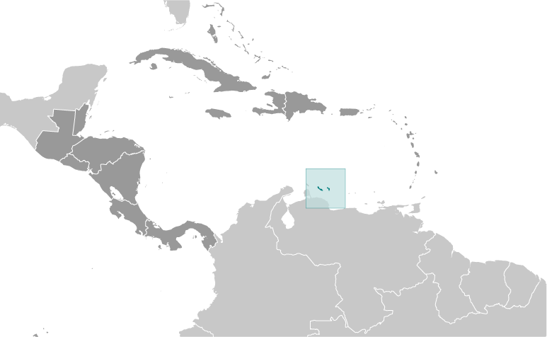
Country Locator

Advertisement


GPS puntos cerca de Cow Pasture


square Bottom Hill (1 km)

square Crispeen (1 km)


square Peak Hill (1 km)


square Sint John (1 km)

square Sint John's (1 km)

square Thais Hill (1 km)

square Bottom (1 km)

square Leverock Town (1 km)

square Pig Rock (1 km)

square Smoky Gut (1 km)

square The Bottom (1 km)


GPS puntos de Antillas Holandesas [ Países Bajos ] (Kingdom Of The Netherlands)

square Roots Netherlands Antilles (general)

square Simson Bay Village Netherlands Antilles (general)

square Landhuis Klein Santa Marta Netherlands Antilles (general)

square Weis Afo Netherlands Antilles (general)

square Great Point Netherlands Antilles (general)

square Landhuis Sint Hyronimus Netherlands Antilles (general)

square Mansion Netherlands Antilles (general)

square Ceru Wecua Netherlands Antilles (general)


viewweather.com sv.ViewWeather.com
fr.ViewWeather.com
da.ViewWeather.com
de.ViewWeather.com
es.ViewWeather.com
www.carpati.org
www.searchromania.net
Deblocari usi
es.getamap.org
fr.getamap.org
de.getamap.org
nl.getamap.org
da.getamap.org
www.getamap.org
Enlaces
Condiciones de uso
Política de privacidad

# 0.0598 sec 

contact AT getamap.net

© 2006 - 2024  https://es.getamap.net/