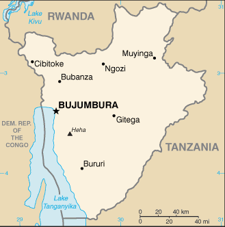
English   Română   Español   Français   Deutsch  

getamap.net

Africa

Oceania

Asia

America del Norte

Europa

America del Sur

La Antártida


Gaharanyonga


3°10'52" S
30°25'3" E
03:14 (CAT - UTC/GMT+2)

Gaharanyonga (Gaharanyonga) es un/una camino (class R - Calles / Autopistas / Carreteras) en (Cankuzo), Burundi (Africa) con un código de región de Africa/Middle East.

Sus coordenadas son 3°10'52" S y 30°25'3" E en formato DMS (grados, minutes, segundos) o -3.18111 y 30.4175 (en grados decimales). Su posición UTM es TB14 y su referencia Joint Operation Graphics es SA36-13.

La hora local actual es 03:14; el sol sale a las 08:55 y se pone a las 21:02 hora local (Africa/Bujumbura UTC/GMT+2). La zona horaria de Gaharanyonga es UTC/GMT+2
En 2024 el horario de verano comienza el - y termina el -.

A Camino es una ruta, pista o ruta utilizada por peatones, animales o vehículos todo terreno.


Country
 Advertisements:


 Advertisements:


El tiempo Gaharanyonga (Nubosidad, Temperatura, Velocidad del viento y Precipitación mm probab.)

Thu


Apr 18
Clound 30-20-10-80 Mist
~2 l/m2 36%
 
17 °C min
22 °C max
6 km/h
Thu Jan 1

Fri


Apr 19
Clound 30-40-20-70 Lightning
~5 l/m2 48%
 
16 °C min
24 °C max
11 km/h
Thu Jan 1

Sat


Apr 20
Clound 30-30-10-90 Lightning
~10 l/m2 65%
 
15 °C min
23 °C max
8 km/h
Thu Jan 1

Sun


Apr 21
Clound 40-20-30-70 Lightning
~21 l/m2 96%
 
15 °C min
24 °C max
8 km/h
Thu Jan 1

Mon


Apr 22
Clound 10-40-100-90 Mist Lightning
~31 l/m2 97%
 
16 °C min
20 °C max
6 km/h
Thu Jan 1

Tue


Apr 23
Clound 30-10-20-80 Lightning
~9 l/m2 53%
 
14 °C min
25 °C max
7 km/h
Thu Jan 1

El tiempo Graph

Mapa y Fotos Gaharanyonga


Comentarios

--- No hay comentarios ---


Anade un comentario nuevo::


Tienes que ingresar para anadir un comentario!


Login


Register

¿Olvidó contraseña?

Burundi (Bujumbura):

Advertisement


GPS puntos cerca de Gaharanyonga

square Manogo (1 km)

square Murufunzo (1 km)

square Nyamutobo (1 km)

square Rukombe (2 km)

square Nyamugari (2 km)

square Gitebuka (2 km)

square Muremera (2 km)

square Nyamwondo (2 km)

square Gicumboro (3 km)

square Gicumburo (3 km)

square Mukiyagara (3 km)

square Mukarira (3 km)

square Gasumo (3 km)

square Kwijeri (3 km)

square Gitobe (3 km)

square Murubindi (3 km)

square Mugasenyi (4 km)


GPS puntos de Burundi (Bujumbura)

square Ecole Primaire Kiremba Iprovense Ya Bururi

square Bayaga Iprovense Ya Rutana

square Butimbo Rutana

square Taba (by05)

square Mabuye Iprovense Ya Cibitoke

square Kirama (by05)

square Ryaruhinda Ngozi

square Muyange Bururi


viewweather.com sv.ViewWeather.com
fr.ViewWeather.com
da.ViewWeather.com
de.ViewWeather.com
es.ViewWeather.com
www.carpati.org
www.searchromania.net
Deblocari usi
es.getamap.org
fr.getamap.org
de.getamap.org
nl.getamap.org
da.getamap.org
www.getamap.org
Enlaces
Condiciones de uso
Política de privacidad

# 0.0650 sec 

contact AT getamap.net

© 2006 - 2024  https://es.getamap.net/